#6982
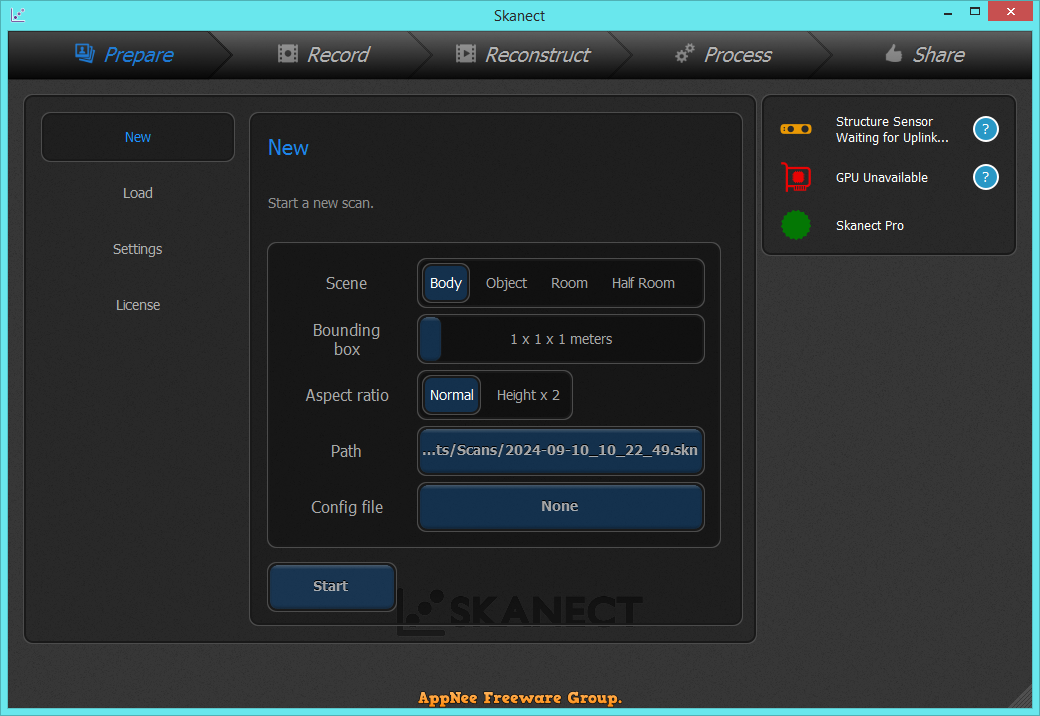
Skanect is a powerful and innovative software solution designed for 3D scanning and modeling, allowing users to capture and create detailed digital representations of real-world objects and environments. Utilizing depth sensors such as the Microsoft Kinect, Skanect enables both professionals and hobbyists to easily generate high-quality 3D models without the need for extensive technical expertise or expensive equipment.
Loading...
Loading...
Loading...
Loading...
Loading...
Loading...
#6292
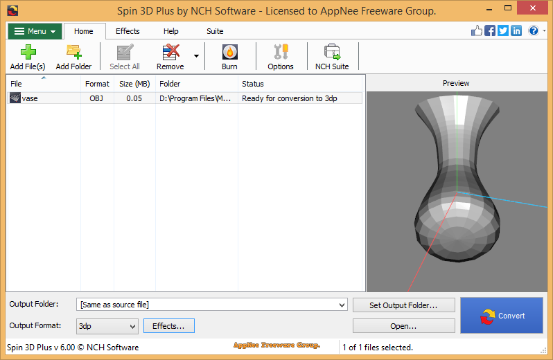
If you need to deal with 3D projects or models frequently, then you often need to convert between multiple 3D file formats, so as to operate proprietary file formats supported by other 3D software in your 3D software. In this case, what you need is a 3D file conversion tool. If you have used FinalMesh, 3D Object Converter, you can also give Spin 3D a try.
Loading...
Loading...
Loading...
Loading...
Loading...
Loading...
Loading...
Loading...
#4854
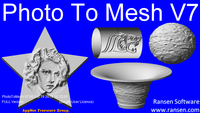
PhotoToMesh is a small and standalone image-to-mesh conversion tool for Windows. It enables user to quickly and easily create complicated 3D meshes (including closed objects) from pictures in any format, no matter they are simple or complex. For example, to create millable signs from simple black and white graphics, to create lithophanes, and more.
Loading...
Loading...
Loading...
Loading...
#4828
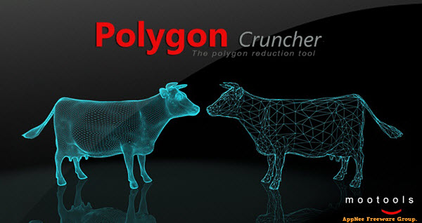
If a 3D scene has a large number of polyhedral models, not only will this cause the reading and displaying speed of the entire scene to become significantly slower, but also the file size will become too large. Fortunately, the mesh of 3D models often comes with a lot of unnecessarily and complex geometries that can be simplified without compromising the model's detail and quality. At this point, we can ask help for Polygon Cruncher.
Loading...
Loading...
Loading...
Loading...
Loading...
Loading...
Loading...
#4795
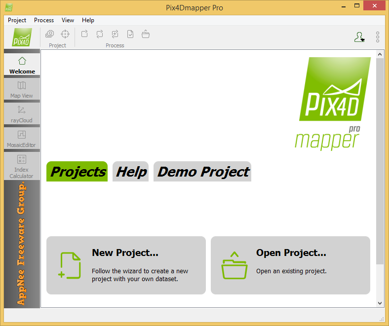
Pix4Dmapper (formerly called Pix4UAV) is a is a fully automatic, fast and professional UAV mapping and photogrammetry software developed by Pix4D from Switzerland. It is the research result of EPFL (École Polytechnique Fédérale de Lausanne), a world-class research institution, in the past 10 years. It is also the unique UAV data and aerial image processing software integrating full-automatic operation, fast processing and professional precision in one place in the market.
Loading...
Loading...
Loading...
Loading...
Loading...
Loading...
Loading...
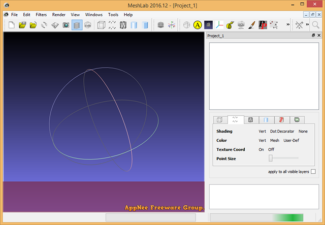
#4019
MeshLab is a free, open-source, portable and extensible three-dimensional geometry (3D meshes) processing system that was developed by the ISTI-CNR research center from Italy, and first published in late 2005. It is mainly used to perform interactive processing and unstructured editing to three-dimensional triangular meshes on Windows, Linux and Mac OS X, and has become popular in many technical fields of 3D development & data handling.
Loading...
Loading...
Loading...
Loading...