#5655
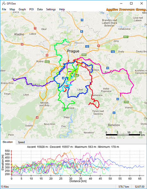
GPXSee is a free, open-source GPS log file viewing and analyzing tool, developed by Martin Tůma from Czech Republic. It comes with a friendly user interface and powerful features, and is mainly used to view and analyze the GPX file (which is the common file type that GPS devices record their waypoints, providing data for GPS navigation).
Loading...
Loading...
Loading...
#5354
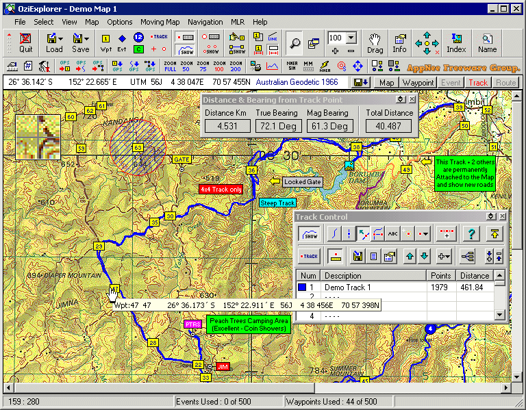
Electronic maps have replaced the traditional printed maps for a long time, especially after GPS became popular. So, most GPS device users should be familiar with OziExplorer. It is a very classic and excellent GPS mapping program developed by Des Newman from Australia in 1996. It is highly customizable, and allows to use and create custom maps for remote locations that are not fully covered by the major map providers like Tele Atlas. Therefore, it is deeply favored by outdoor enthusiasts (especially off-road drivers and adventure travelers).
Loading...
Loading...
Loading...
Loading...
Loading...
Loading...
Loading...
#5280
OkMap is undoubtedly the favorite software of many outdoor enthusiasts. It can perfectly fit the Garmin or Magellan GPS devices, enabling your to quickly find your own position and work out the best route to take in various recreational activities, for example in the wild professional activities, in the outdoor sports, as well as in the nature (search and rescue, navigation, cross-country around mountains, mountain biking, hiking, rock climbing, picnic, outing, sea fishing, and other environment).
Loading...
Loading...
Loading...
Loading...
Loading...
Loading...
Loading...
Loading...
Loading...
Loading...
Loading...
#5126
BackCountry Navigator (AKA: BackCountry Navigator TOPO GPS) is an offline GPS map navigation app mainly used for outdoor adventures, developed by CritterMap Software. It can turn your Android-based smartphone or tablet into an outdoor navigation tool that can perfectly replace the traditional handheld GPS devices. Although the software is small in size, it is powerful enough, and supports downloading maps and aerial photos over the Internet.
Loading...
Loading...
Loading...
Loading...
Loading...
Loading...
#4396
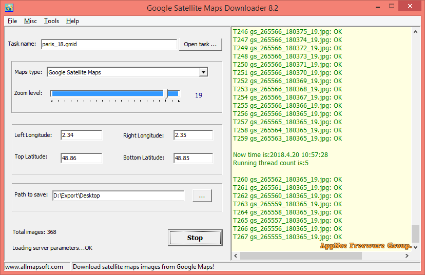
If you need to make a high-resolution satellite map of a city or any specified area, then AllMapSoft's Google Satellite Maps Downloader (GSMD for short) this straightforward and intuitive small app can help you a lot. It automatically and very fast downloads numerous small piece of satellite maps on Google Maps (according to the user specified geographical coordinates: latitude and longitude range + zoom level) with ease, then combines them together and outputs as a huge image file in multiple common-used formats.
Loading...
Loading...
Loading...
Loading...
Loading...