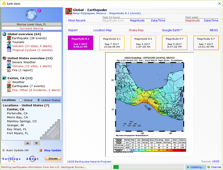
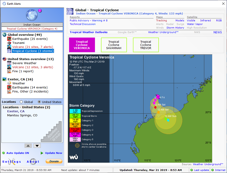
Earth Alerts is a practical natural disaster forecasting and warning system that can monitor and let users know all kinds of natural disaster events happening around the world in real time. It not only highlights the location of happening natural disasters on earth today with visual images, but also attaches detailed descriptive data. Better yet, all the data is updated online in real time.
To use Earth Alerts, you can simply select specific types of natural disasters - earthquakes, tsunamis, volcanoes, tropical cyclones, wildfires, landslides, severe weather, local weather etc., as well as the areas you are interested in. It will then automatically retrieve the latest information from various real-time data sources available on the Internet, and present it to you in a convenient way with reports, maps and images.
Earth Alerts uses various online resources issued by National Weather Service (NWS), United States Geological Survey (USGS), Smithsonian Institution and other institutions to determine what kind of activities our Mother Earth is currently operating on this planet. It is worth noting that Earth Alerts can be integrated with Google Earth, so that users can view the cataclysms that have happened using satellite photos, of course high resolution. If you follow such natural phenomena, you can put an audible alert, it will work if the threat is fixed somewhere.
Unfortunately, although this software is named after "Earth Alerts", it is actually much more specific to the U.S. regions (i.e.: support for other countries is less than perfect), with all information coming from the local, related institutions or organisations. In other words, the various data contents displayed in this software need to be connected to servers in the United States, so the connection speed from other countries and completeness, effectiveness of information may not be ideal enough.
Key Features
| Feature | Description |
| Global activity overview | Earthquakes, tsunamis, volcanoes, and tropical cyclones (typhoons, hurricanes, tropical storms, tropical depressions and other disturbances) |
| Activity for user-selected Global locations (anywhere outside the U.S.) | Local earthquakes, local weather including current conditions, forecasts and satellite imagery |
| United States activity overview | Severe weather including special tornado and severe thunderstorm watches, volcanoes, wildfires, and landslide related hazards |
| Activity for user-selected United States locations | Earthquakes, wildfires and local weather including NWS weather/hazard alerts, current conditions, forecasts and radar/satellite imagery |
| Google Earth integration | Google Earth integration provides visualizations of recent earthquake events, volcanoes, tropical cyclones, wildfires and severe weather warnings. Google Earth integration also provides high resolution views of any user-selected U.S. or Global location |
| Visual feedback | Visual and sound notifications on your Windows desktop identifying active alerts |
| Information on any type of natural hazard tracked by Earth Alerts can be automatically sent by email as soon as an alert is raised; email messages contain the same alert reports and images as shown in the Earth Alerts application screens | |
| Mobile Devices | SMS/MMS-based messages containing summary alert information with related images can be automatically sent to your mobile device; these notifications cover the most severe natural hazard events, including major earthquakes, tsunami watches/warnings, volcanic eruptions and tornado warnings |
System Requirements
- Microsoft Windows 7+
- Microsoft .NET Framework 4.8
Download URLs
| License | Version | Download | Size |
| Freeware | Latest |  (mir) (mir) |
n/a |