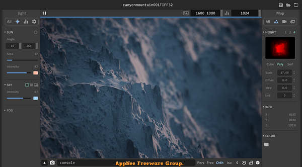
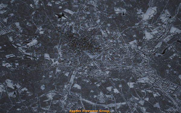
Aerialod is a very easy to use, free and open-source 3D terrain generation edge tool, developed by ephtracy (the author of MagicaVoxel). It can help you easily generate various types of terrains, render real satellite data, generate synthetic height maps, use HDR rendering, output maps up to 16K, and much more. This is enough to make it easy and fast for any user who doesn't know anything about modeling to create a 3D map.
Aerialod comes with small file size, clean user interface, simple operations, and amazing real-time rendering speed. Drag in images to automatically generate terrain maps and render them in real time. Zoom in and out and the details are very clear. The right editing box can adjust the number of model segments, volume, minimum sampling range, step level, etc. The left editing box is to adjust lighting, sky, fog and other parameters.
Aerialod is essentially an interactive path tracing renderer for height maps, which supports polygon and bilinear surface rendering modes, supports rendering height maps of size up to 16384*16384, importing and exporting 8-bit/16-bit/32-bit PNG/JPG/TIF format of image, as well as exporting PLY format of mesh.
Fan Made Demo Videos
Download URLs
| License | Version | Download | Size |
| Freeware | Latest |  |
n/a |